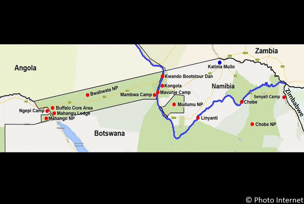
The Caprivi Strip!
«The Caprivi Strip is a unique topographical feature on the map of southern Africa. The area is approximately 450 km long and only up to 50 km wide. In the Heligoland-Zanzibar Treaty of July 1, 1890, Germany and England regulated their colonial relationships in East, Southwest and West Africa (Togo). The German Reich received Helgoland, which was important for the defense of the North Sea coast. In return, it ceded control of Witu in East Africa and was given access to the Zambezi in German South West Africa. (Witu was an African sultanate on the northern coast of modern-day Kenya.) The area was named after the Chancellor Count von Caprivi.» (Source: Iwanowski’s Namibia, 31st edition)
Two large rivers, the Okavango and the Kwando, traverse this strip of land from north to south. The abundance of water in this area and the fertile shore land ensure that grain, fruit and vegetables can be planted here. The Okavango is also rich in freshwater fish, which are often served here.
A special feature of the Caprivi Strip is that the borders of five countries meet: Angola, Zambia, Botswana, Zimbabwe and Namibia. Elephants, buffalo, hippos and other wild animals can be seen in the many national parks in this area. Our next destination will be the Bwabwata, Mudumu and Mamili (now Nkasa Lupala) national parks.
PS. In 2013 the Caprivi region was renamed the Zambezi region. But the original and unusual name will probably stick around for a long time …


